
Photograph of a shelf cloud showing the potential development of a derecho event over farmland. Photographer: Sumie Dh
When temperatures begin to climb in the United States during the spring and summer months, hot and humid weather conditions nurture the formation of thunderstorms. With those thunderstorms comes the potential for a dangerous wind event known as a derecho.
As destructive as tornadoes with damage areas rivaling hurricanes, a derecho is a unique weather phenomenon characterized by powerful, straight-line winds. In fact, the name, “derecho,” comes from the Spanish word for straight or direct. These straight-line windstorms can occur with little warning, cover wide areas, and move very quickly. With the continuing rise in temperatures due to climate change, derechos may become more common, so it’s important to understand the key elements of this weather phenomenon and the danger derechos pose.
Key Criteria for a Derecho
To be classified as a derecho, a storm system must meet a few meteorological standards according to the National Weather Service:
Damage Area: The zone where wind damage can be attributed to the storm system must extend at least 240 miles (or 400 kilometers).
Wind Speed: The storm system must produce consistent wind gusts of at least 58 miles per hour (or 93 kilometers per hour).
Well-Separated Gusts: Hurricane-force wind gusts of 75 miles per hour (121 kilometers per hour) must be present in separate parts of the storm system.
Rapid Storm Movement: The forward speed of the storm system must exceed the environmental mean wind speed, which suggests the storm is primarily driven by a pocket of dense, chilled air known as a cold pool.
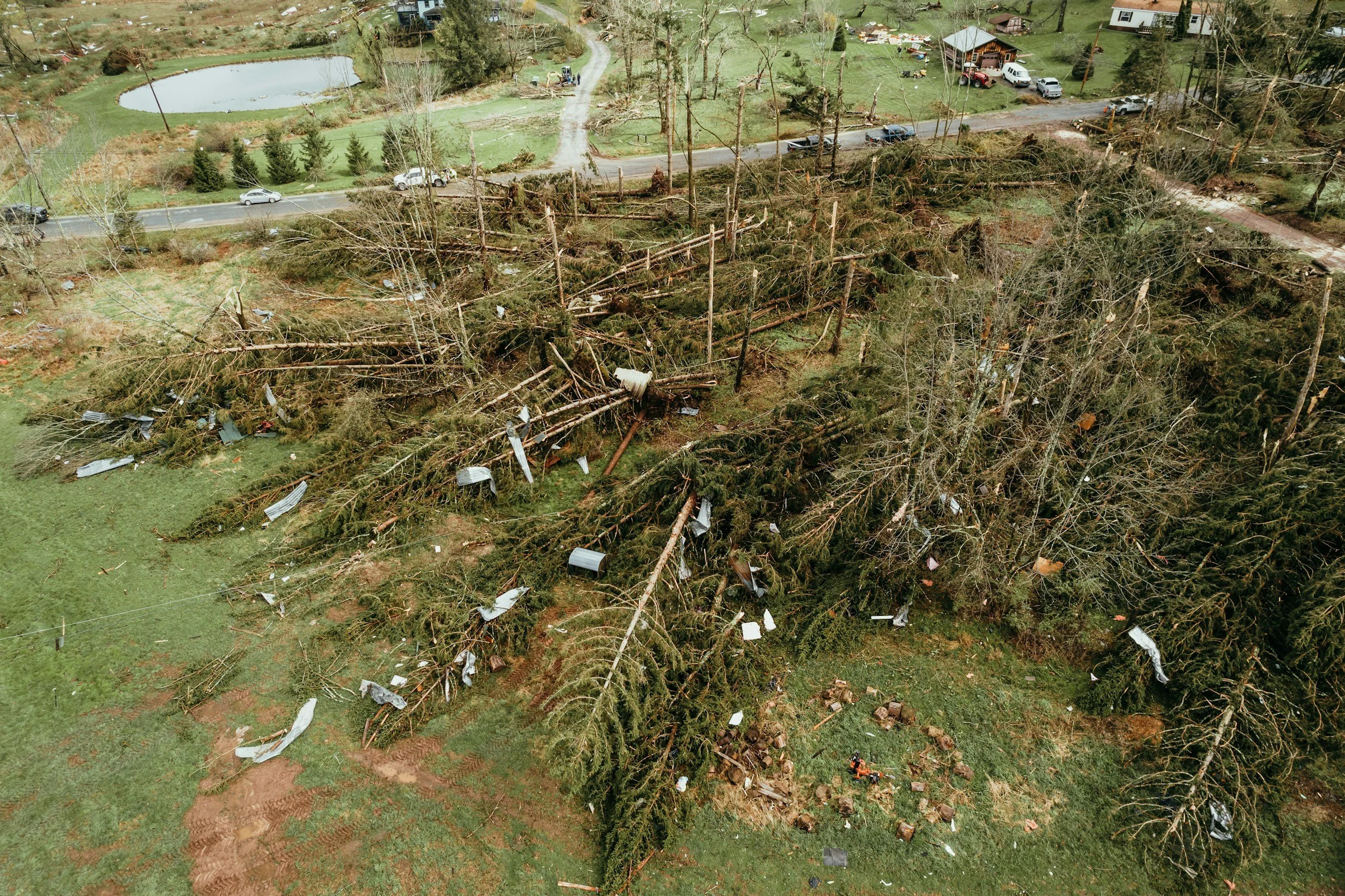
Photograph of downed trees that suggests the damage was caused by straight-line winds similar to those found in a derecho.
How Derechos are Formed
Derechos develop when a group of thunderstorms merge and organize into a larger collective storm called a mesoscale convective system (MCS). Often, an MCS will be accompanied by a squall line that contains high wind and heavy rain. A hallmark of a derecho event is a squall line with a slight curve. This is known as a bow echo because the storm system resembles an archer’s bow on weather radar.
Similar to other weather phenomena like hurricanes or tornadoes, derechos require very specific atmospheric conditions. First, a derecho requires lots of energy in the form of hot and often humid air combined with fast-moving winds higher up in the atmosphere to help organize the storm system. As this warmer air gets pushed along by those higher winds, it inevitably meets a cold front or a low-pressure system, creating a thunderstorm.
Once the thunderstorm begins, the rain-cooled downdraft will spread horizontally on the earth’s surface. As the cooler and denser air spreads outward, it forces warmer, wetter, and lighter air to the leading edge of the storm system, creating a gust front (also called a shelf or arcus cloud). This can create a self-sustaining system as long as there is additional warm and moist air to feed the storm. Next, strong winds from the back of the storm rush into the middle of the storm line (known as a rear-inflow jet), which pushes the center of the storm forward and creates the bow effect.
When all of those components come together, the result is a derecho that can last for a few minutes to several hours or even longer and wreak havoc over a significant distance. The July 2011 Midwest/Cross County Derecho is widely recognized as one of the longest-lasting derechos on record, traveling approximately 1,300 miles across the central and eastern US over the course of 18 hours. More recently, the August 2020 Midwest Derecho lasted 14 hours and covered nearly 700 miles from the Iowa-Nebraska border to the Ohio River Valley, causing $11.5 billion in damages to become the costliest thunderstorm event in US history.
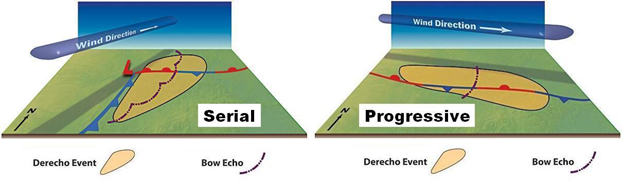
Diagram showing the difference between a serial derecho and a progressive derecho. Original illustration by Dennis Cain
Types of Derechos
Derechos can occur in different seasons and manifest in a variety of shapes and sizes. There are two primary types of derechos (serial and progressive) along with two additional forms (hybrid and low-dewpoint) that have been characterized by meteorologists.
Serial Derechos
Serial derechos commonly occur during the spring and fall and are characterized by a vast low-pressure system with multiple bow echoes in a large squall line that can be hundreds of miles long. A serial derecho will often cover a sizable area from north to south and west to east.
Progressive Derechos
Progressive derechos occur mainly during the summer months and are often smaller than their serial counterparts. This type of derecho is associated with a relatively short line of thunderstorms (approximately 40 miles to 250 miles long) with a single bow echo. While progressive derechos may traverse a long west-to-east area, the storm system often remains narrower from north to south.
Hybrid Derechos
Certain storm systems can present characteristics of both a serial and progressive derecho. These events are known as hybrid derechos and often display the structural configuration of a serial derecho combined with the speed of movement and localized destruction of a progressive derecho.
Low-Dewpoint Derechos
Most derecho-producing thunderstorms occur when the surface dewpoints are at or above 70° Fahrenheit. However, there have been recorded derecho events in environments of more limited moisture, with dewpoints in the 40s or 50s. These are known as low-dewpoint derechos, and they often occur during the late fall and early spring in concert with strong low-pressure systems or during warmer months in the drier regions of the United States.
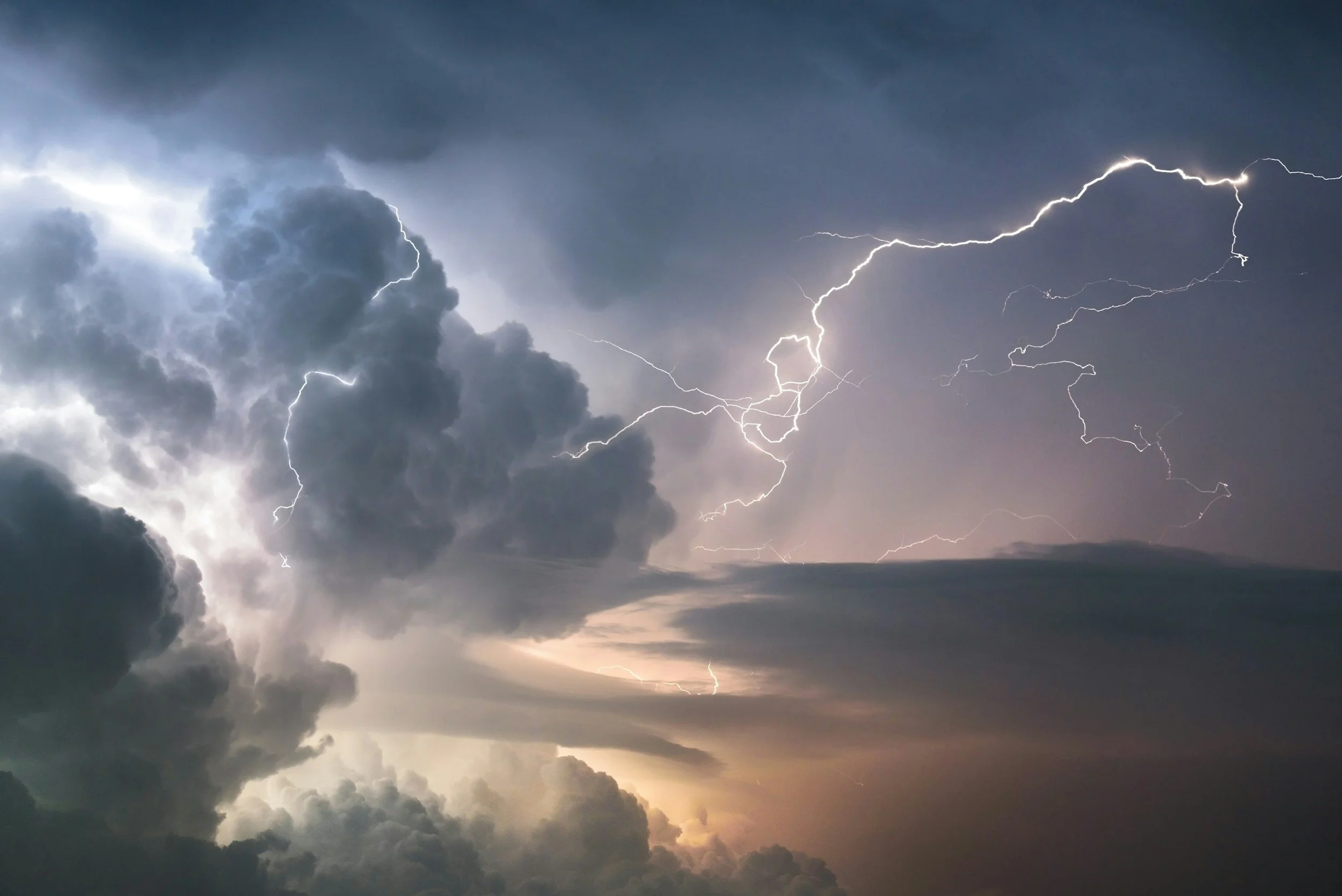
Image of a thunderstorm showing cloud-to-cloud lightning
What to do Before, During & After a Derecho
Because derechos move quickly and often offer little warning, it can be difficult to properly prepare for such an event. During many previous derechos, those most at risk are individuals engaged in outdoor activities and/or without adequate shelter, so the most important thing to do is to have an emergency plan in place before a derecho occurs. Beyond planning, there are a few other steps you can take to protect yourself and your loved ones:
Before a Derecho
Secure any loose items outside of your home, such as patio furniture, trash cans, plant pots, grills, tools, and recreational items.
Keep your trees trimmed and look out for dead or dying branches that can break off in high wind and cause property damage or pose a health risk.
Know where to take refuge. In a derecho event, the safest place is often a basement, cellar, or interior room without windows located on a lower level of your home.
Make sure your devices like phones, power banks, laptops, and/or emergency radios are fully charged.
Prepare an emergency kit with a few days’ worth of food, water, and medicine, as well as flashlights with extra batteries, a first aid kit, and a whistle (to signal for help if needed).
During a Derecho
Move indoors as soon as possible and take shelter in your previously identified point of refuge.
Stay away from windows and doors and be aware of flying debris.
If you are in your vehicle when the storm hits, pull over as soon as you can safely do so. Park your vehicle away from tall trees or power lines and look for shelter or stay with your vehicle if no other options are available.
After a Derecho
Beware of downed power lines. If you encounter any power lines on the ground, assume that they are live and keep your distance.
Inspect your home for damage. Check your basement for any leaks or water damage, examine your roof for loose or missing shingles, and clear any debris around your house and property.
Stay informed. Listen to guidance from local authorities regarding power outages, localized flooding, and clean up or recovery efforts.
Additional Resources:
Bow Echoes | National Oceanic and Atmospheric Administration
Thunderstorm Safety | American Red Cross
Worst Derechos in US History: Costliest & Deadliest | DisasterAWARE
Notable Derechos | National Oceanic and Atmospheric Administration